File:Colourful houses on Moor Road, Longtown - geograph.org.uk - 6148492.jpg
No higher resolution available.
Colourful_houses_on_Moor_Road,_Longtown_-_geograph.org.uk_-_6148492.jpg (640 × 480 pixels, file size: 294 KB, MIME type: image/jpeg)
File information
Structured data
Captions
Captions
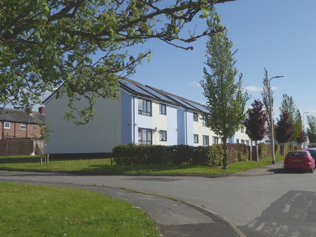
Colourful houses on Moor Road, Longtown
Summary
| DescriptionColourful houses on Moor Road, Longtown - geograph.org.uk - 6148492.jpg |
English: Colourful houses on Moor Road, Longtown |
| Depicts InfoField | house, suburb, Arthuret |
| Date |
|
| Source |
Geograph Britain and Ireland |
| Author |
Oliver Dixon |
| Place of creation InfoField | Arthuret |
| Camera location | 55° 00′ 39.8″ N, 2° 57′ 43.4″ W | View this and other nearby images on: OpenStreetMap |
|---|
| Object location | 55° 00′ 40.3″ N, 2° 57′ 43″ W | View this and other nearby images on: OpenStreetMap |
|---|
Licensing

|
This image was taken from the Geograph project collection. See this photograph's page on the Geograph website for the photographer's contact details. The copyright on this image is owned by Oliver Dixon
|
This file is licensed under the Creative Commons Attribution-Share Alike 2.0 Generic license.
Attribution:
Colourful houses on Moor Road, Longtown by Oliver Dixon
- You are free:
- to share – to copy, distribute and transmit the work
- to remix – to adapt the work
- Under the following conditions:
- attribution – You must give appropriate credit, provide a link to the license, and indicate if changes were made. You may do so in any reasonable manner, but not in any way that suggests the licensor endorses you or your use.
- share alike – If you remix, transform, or build upon the material, you must distribute your contributions under the same or compatible license as the original.
File history
Click on a date/time to view the file as it appeared at that time.
| Date/Time | Thumbnail | Dimensions | User | Comment | |
|---|---|---|---|---|---|
| current | 00:34, 18 January 2024 | | 640 × 480 (294 KB) | GeographBot (talk | contribs) | Uploading geograph.org.uk image from https://www.geograph.org.uk/photo/6148492 |
You cannot overwrite this file.
File usage on Commons
There are no pages that use this file.
Metadata
This file contains additional information such as Exif metadata which may have been added by the digital camera, scanner, or software program used to create or digitize it. If the file has been modified from its original state, some details such as the timestamp may not fully reflect those of the original file. The timestamp is only as accurate as the clock in the camera, and it may be completely wrong.
| Camera manufacturer | Panasonic |
|---|---|
| Camera model | DMC-TZ60 |
| Exposure time | 1/1,000 sec (0.001) |
| F-number | f/3.7 |
| ISO speed rating | 100 |
| Date and time of data generation | 09:43, 10 May 2019 |
| Lens focal length | 6.7 mm |
| Latitude | 55° 0′ 39.8″ N |
| Longitude | 2° 57′ 43.39″ W |
| Altitude | 21 meters above sea level |
| Software used | GIMP 2.10.6 |
| File change date and time | 07:53, 11 May 2019 |
| Y and C positioning | Co-sited |
| Exposure Program | Landscape mode (for landscape photos with the background in focus) |
| Exif version | 2.3 |
| Date and time of digitizing | 09:43, 10 May 2019 |
| Meaning of each component |
|
| Image compression mode | 4 |
| APEX exposure bias | 0 |
| Maximum land aperture | 3.7734375 APEX (f/3.7) |
| Metering mode | Pattern |
| Light source | Unknown |
| Flash | Flash did not fire, compulsory flash suppression |
| Supported Flashpix version | 1 |
| Color space | sRGB |
| Sensing method | One-chip color area sensor |
| File source | Digital still camera |
| Scene type | A directly photographed image |
| Custom image processing | Normal process |
| Exposure mode | Auto exposure |
| White balance | Auto white balance |
| Digital zoom ratio | 0 |
| Focal length in 35 mm film | 39 mm |
| Scene capture type | Standard |
| Scene control | None |
| Contrast | Normal |
| Saturation | Normal |
| Sharpness | Normal |
| Geodetic survey data used | WGS-84 |
| GPS tag version | 2.2.0.0 |
Structured data
depicts<\/a>"}},"text\/plain":{"en":{"":"depicts"}}},"{\"value\":{\"entity-type\":\"item\",\"numeric-id\":3947,\"id\":\"Q3947\"},\"type\":\"wikibase-entityid\"}":{"text\/html":{"en":{"P180":"<a target=\"_blank\" title=\"d:Special:EntityPage\/Q3947\" href=\"https:\/\/www.wikidata.org\/wiki\/Special:EntityPage\/Q3947\">house<\/a>"}},"text\/plain":{"en":{"P180":"house"}}},"{\"value\":{\"entity-type\":\"item\",\"numeric-id\":188509,\"id\":\"Q188509\"},\"type\":\"wikibase-entityid\"}":{"text\/html":{"en":{"P180":"<a target=\"_blank\" title=\"d:Special:EntityPage\/Q188509\" href=\"https:\/\/www.wikidata.org\/wiki\/Special:EntityPage\/Q188509\">suburb<\/a>"}},"text\/plain":{"en":{"P180":"suburb"}}},"{\"value\":{\"entity-type\":\"item\",\"numeric-id\":1160465,\"id\":\"Q1160465\"},\"type\":\"wikibase-entityid\"}":{"text\/html":{"en":{"P180":"<a target=\"_blank\" title=\"d:Special:EntityPage\/Q1160465\" href=\"https:\/\/www.wikidata.org\/wiki\/Special:EntityPage\/Q1160465\">Arthuret<\/a>"}},"text\/plain":{"en":{"P180":"Arthuret"}}}}" class="wbmi-entityview-statementsGroup wbmi-entityview-statementsGroup-P180 oo-ui-layout oo-ui-panelLayout oo-ui-panelLayout-framed">
creator<\/a>"}},"text\/plain":{"en":{"":"creator"}}},"{\"value\":{\"entity-type\":\"property\",\"numeric-id\":3831,\"id\":\"P3831\"},\"type\":\"wikibase-entityid\"}":{"text\/html":{"en":{"":"<a target=\"_blank\" title=\"d:Special:EntityPage\/P3831\" href=\"https:\/\/www.wikidata.org\/wiki\/Special:EntityPage\/P3831\">object of statement has role<\/a>"}},"text\/plain":{"en":{"":"object of statement has role"}}},"{\"value\":{\"entity-type\":\"item\",\"numeric-id\":33231,\"id\":\"Q33231\"},\"type\":\"wikibase-entityid\"}":{"text\/html":{"en":{"P3831":"<a target=\"_blank\" title=\"d:Special:EntityPage\/Q33231\" href=\"https:\/\/www.wikidata.org\/wiki\/Special:EntityPage\/Q33231\">photographer<\/a>"}},"text\/plain":{"en":{"P3831":"photographer"}}},"{\"value\":{\"entity-type\":\"property\",\"numeric-id\":2093,\"id\":\"P2093\"},\"type\":\"wikibase-entityid\"}":{"text\/html":{"en":{"":"<a target=\"_blank\" title=\"d:Special:EntityPage\/P2093\" href=\"https:\/\/www.wikidata.org\/wiki\/Special:EntityPage\/P2093\">author name string<\/a>"}},"text\/plain":{"en":{"":"author name string"}}},"{\"value\":\"Oliver Dixon\",\"type\":\"string\"}":{"text\/html":{"en":{"P2093":"Oliver Dixon"}},"text\/plain":{"en":{"P2093":"Oliver Dixon"}}},"{\"value\":{\"entity-type\":\"property\",\"numeric-id\":2699,\"id\":\"P2699\"},\"type\":\"wikibase-entityid\"}":{"text\/html":{"en":{"":"<a target=\"_blank\" title=\"d:Special:EntityPage\/P2699\" href=\"https:\/\/www.wikidata.org\/wiki\/Special:EntityPage\/P2699\">URL<\/a>"}},"text\/plain":{"en":{"":"URL"}}},"{\"value\":\"https:\\\/\\\/www.geograph.org.uk\\\/profile\\\/3462\",\"type\":\"string\"}":{"text\/html":{"en":{"P2699":"<a target=\"_blank\" rel=\"nofollow\" class=\"external free\" href=\"https:\/\/www.geograph.org.uk\/profile\/3462\">https:\/\/www.geograph.org.uk\/profile\/3462<\/a>"}},"text\/plain":{"en":{"P2699":"https:\/\/www.geograph.org.uk\/profile\/3462"}}}}" class="wbmi-entityview-statementsGroup wbmi-entityview-statementsGroup-P170 oo-ui-layout oo-ui-panelLayout oo-ui-panelLayout-framed">
some value
copyright status<\/a>"}},"text\/plain":{"en":{"":"copyright status"}}},"{\"value\":{\"entity-type\":\"item\",\"numeric-id\":50423863,\"id\":\"Q50423863\"},\"type\":\"wikibase-entityid\"}":{"text\/html":{"en":{"P6216":"<a target=\"_blank\" title=\"d:Special:EntityPage\/Q50423863\" href=\"https:\/\/www.wikidata.org\/wiki\/Special:EntityPage\/Q50423863\">copyrighted<\/a>"}},"text\/plain":{"en":{"P6216":"copyrighted"}}}}" class="wbmi-entityview-statementsGroup wbmi-entityview-statementsGroup-P6216 oo-ui-layout oo-ui-panelLayout oo-ui-panelLayout-framed">
copyright license<\/a>"}},"text\/plain":{"en":{"":"copyright license"}}},"{\"value\":{\"entity-type\":\"item\",\"numeric-id\":19068220,\"id\":\"Q19068220\"},\"type\":\"wikibase-entityid\"}":{"text\/html":{"en":{"P275":"<a target=\"_blank\" title=\"d:Special:EntityPage\/Q19068220\" href=\"https:\/\/www.wikidata.org\/wiki\/Special:EntityPage\/Q19068220\">Creative Commons Attribution-ShareAlike 2.0 Generic<\/a>"}},"text\/plain":{"en":{"P275":"Creative Commons Attribution-ShareAlike 2.0 Generic"}}},"{\"value\":{\"entity-type\":\"property\",\"numeric-id\":1476,\"id\":\"P1476\"},\"type\":\"wikibase-entityid\"}":{"text\/html":{"en":{"":"<a target=\"_blank\" title=\"d:Special:EntityPage\/P1476\" href=\"https:\/\/www.wikidata.org\/wiki\/Special:EntityPage\/P1476\">title<\/a>"}},"text\/plain":{"en":{"":"title"}}},"{\"value\":{\"text\":\"Colourful houses on Moor Road, Longtown\",\"language\":\"en\"},\"type\":\"monolingualtext\"}":{"text\/html":{"en":{"P1476":"<span lang=\"en\" class=\"wb-monolingualtext-value\">Colourful houses on Moor Road, Longtown<\/span> <span class=\"wb-monolingualtext-language-name\" dir=\"auto\">(English)<\/span>"}},"text\/plain":{"en":{"P1476":"Colourful houses on Moor Road, Longtown"}}},"{\"value\":{\"entity-type\":\"property\",\"numeric-id\":2093,\"id\":\"P2093\"},\"type\":\"wikibase-entityid\"}":{"text\/html":{"en":{"":"<a target=\"_blank\" title=\"d:Special:EntityPage\/P2093\" href=\"https:\/\/www.wikidata.org\/wiki\/Special:EntityPage\/P2093\">author name string<\/a>"}},"text\/plain":{"en":{"":"author name string"}}},"{\"value\":\"Oliver Dixon\",\"type\":\"string\"}":{"text\/html":{"en":{"P2093":"Oliver Dixon"}},"text\/plain":{"en":{"P2093":"Oliver Dixon"}}}}" class="wbmi-entityview-statementsGroup wbmi-entityview-statementsGroup-P275 oo-ui-layout oo-ui-panelLayout oo-ui-panelLayout-framed">
instance of<\/a>"}},"text\/plain":{"en":{"":"instance of"}}},"{\"value\":{\"entity-type\":\"item\",\"numeric-id\":125191,\"id\":\"Q125191\"},\"type\":\"wikibase-entityid\"}":{"text\/html":{"en":{"P31":"<a target=\"_blank\" title=\"d:Special:EntityPage\/Q125191\" href=\"https:\/\/www.wikidata.org\/wiki\/Special:EntityPage\/Q125191\">photograph<\/a>"}},"text\/plain":{"en":{"P31":"photograph"}}}}" class="wbmi-entityview-statementsGroup wbmi-entityview-statementsGroup-P31 oo-ui-layout oo-ui-panelLayout oo-ui-panelLayout-framed">
source of file<\/a>"}},"text\/plain":{"en":{"":"source of file"}}},"{\"value\":{\"entity-type\":\"item\",\"numeric-id\":74228490,\"id\":\"Q74228490\"},\"type\":\"wikibase-entityid\"}":{"text\/html":{"en":{"P7482":"<a target=\"_blank\" title=\"d:Special:EntityPage\/Q74228490\" href=\"https:\/\/www.wikidata.org\/wiki\/Special:EntityPage\/Q74228490\">file available on the internet<\/a>"}},"text\/plain":{"en":{"P7482":"file available on the internet"}}},"{\"value\":{\"entity-type\":\"property\",\"numeric-id\":137,\"id\":\"P137\"},\"type\":\"wikibase-entityid\"}":{"text\/html":{"en":{"":"<a target=\"_blank\" title=\"d:Special:EntityPage\/P137\" href=\"https:\/\/www.wikidata.org\/wiki\/Special:EntityPage\/P137\">operator<\/a>"}},"text\/plain":{"en":{"":"operator"}}},"{\"value\":{\"entity-type\":\"item\",\"numeric-id\":1503119,\"id\":\"Q1503119\"},\"type\":\"wikibase-entityid\"}":{"text\/html":{"en":{"P137":"<a target=\"_blank\" title=\"d:Special:EntityPage\/Q1503119\" href=\"https:\/\/www.wikidata.org\/wiki\/Special:EntityPage\/Q1503119\">Geograph Britain and Ireland<\/a>"}},"text\/plain":{"en":{"P137":"Geograph Britain and Ireland"}}},"{\"value\":{\"entity-type\":\"property\",\"numeric-id\":7384,\"id\":\"P7384\"},\"type\":\"wikibase-entityid\"}":{"text\/html":{"en":{"":"<a target=\"_blank\" title=\"d:Special:EntityPage\/P7384\" href=\"https:\/\/www.wikidata.org\/wiki\/Special:EntityPage\/P7384\">geograph.org.uk image ID<\/a>"}},"text\/plain":{"en":{"":"geograph.org.uk image ID"}}},"{\"value\":\"6148492\",\"type\":\"string\"}":{"text\/html":{"en":{"P7384":"<a target=\"_blank\" class=\"wb-external-id external\" href=\"https:\/\/www.geograph.org.uk\/photo\/6148492\" rel=\"nofollow\">6148492<\/a>"}},"text\/plain":{"en":{"P7384":"6148492"}}},"{\"value\":{\"entity-type\":\"property\",\"numeric-id\":973,\"id\":\"P973\"},\"type\":\"wikibase-entityid\"}":{"text\/html":{"en":{"":"<a target=\"_blank\" title=\"d:Special:EntityPage\/P973\" href=\"https:\/\/www.wikidata.org\/wiki\/Special:EntityPage\/P973\">described at URL<\/a>"}},"text\/plain":{"en":{"":"described at URL"}}},"{\"value\":\"https:\\\/\\\/www.geograph.org.uk\\\/photo\\\/6148492\",\"type\":\"string\"}":{"text\/html":{"en":{"P973":"<a target=\"_blank\" rel=\"nofollow\" class=\"external free\" href=\"https:\/\/www.geograph.org.uk\/photo\/6148492\">https:\/\/www.geograph.org.uk\/photo\/6148492<\/a>"}},"text\/plain":{"en":{"P973":"https:\/\/www.geograph.org.uk\/photo\/6148492"}}}}" class="wbmi-entityview-statementsGroup wbmi-entityview-statementsGroup-P7482 oo-ui-layout oo-ui-panelLayout oo-ui-panelLayout-framed">
inception<\/a>"}},"text\/plain":{"en":{"":"inception"}}},"{\"value\":{\"time\":\"+2019-05-10T00:00:00Z\",\"timezone\":0,\"before\":0,\"after\":0,\"precision\":11,\"calendarmodel\":\"http:\\\/\\\/www.wikidata.org\\\/entity\\\/Q1985727\"},\"type\":\"time\"}":{"text\/html":{"en":{"P571":"10 May 2019"}},"text\/plain":{"en":{"P571":"10 May 2019"}}}}" class="wbmi-entityview-statementsGroup wbmi-entityview-statementsGroup-P571 oo-ui-layout oo-ui-panelLayout oo-ui-panelLayout-framed">
10 May 2019
coordinates of the point of view<\/a>"}},"text\/plain":{"en":{"":"coordinates of the point of view"}}},"{\"value\":{\"latitude\":55.01105300921865,\"longitude\":-2.9620531450399343,\"altitude\":null,\"precision\":1.0e-5,\"globe\":\"http:\\\/\\\/www.wikidata.org\\\/entity\\\/Q2\"},\"type\":\"globecoordinate\"}":{"text\/html":{"en":{"P1259":"55\u00b00'39.78"N, 2\u00b057'43.38"W"}},"text\/plain":{"en":{"P1259":"55\u00b00'39.78\"N, 2\u00b057'43.38\"W"}}},"{\"value\":{\"entity-type\":\"property\",\"numeric-id\":7787,\"id\":\"P7787\"},\"type\":\"wikibase-entityid\"}":{"text\/html":{"en":{"":"<a target=\"_blank\" title=\"d:Special:EntityPage\/P7787\" href=\"https:\/\/www.wikidata.org\/wiki\/Special:EntityPage\/P7787\">heading<\/a>"}},"text\/plain":{"en":{"":"heading"}}},"{\"value\":{\"amount\":\"+22\",\"unit\":\"http:\\\/\\\/www.wikidata.org\\\/entity\\\/Q28390\"},\"type\":\"quantity\"}":{"text\/html":{"en":{"P7787":"22 <span class=\"wb-unit\">degree<\/span>"}},"text\/plain":{"en":{"P7787":"22 degree"}}}}" class="wbmi-entityview-statementsGroup wbmi-entityview-statementsGroup-P1259 oo-ui-layout oo-ui-panelLayout oo-ui-panelLayout-framed">
55°0'39.78"N, 2°57'43.38"W
coordinates of depicted place<\/a>"}},"text\/plain":{"en":{"":"coordinates of depicted place"}}},"{\"value\":{\"latitude\":55.01120770782334,\"longitude\":-2.9619482937634256,\"altitude\":null,\"precision\":0.0001,\"globe\":\"http:\\\/\\\/www.wikidata.org\\\/entity\\\/Q2\"},\"type\":\"globecoordinate\"}":{"text\/html":{"en":{"P9149":"55\u00b00'40.3"N, 2\u00b057'42.8"W"}},"text\/plain":{"en":{"P9149":"55\u00b00'40.3\"N, 2\u00b057'42.8\"W"}}}}" class="wbmi-entityview-statementsGroup wbmi-entityview-statementsGroup-P9149 oo-ui-layout oo-ui-panelLayout oo-ui-panelLayout-framed">
55°0'40.3"N, 2°57'42.8"W
location of creation<\/a>"}},"text\/plain":{"en":{"":"location of creation"}}},"{\"value\":{\"entity-type\":\"item\",\"numeric-id\":1160465,\"id\":\"Q1160465\"},\"type\":\"wikibase-entityid\"}":{"text\/html":{"en":{"P1071":"<a target=\"_blank\" title=\"d:Special:EntityPage\/Q1160465\" href=\"https:\/\/www.wikidata.org\/wiki\/Special:EntityPage\/Q1160465\">Arthuret<\/a>"}},"text\/plain":{"en":{"P1071":"Arthuret"}}}}" class="wbmi-entityview-statementsGroup wbmi-entityview-statementsGroup-P1071 oo-ui-layout oo-ui-panelLayout oo-ui-panelLayout-framed">
media type<\/a>"}},"text\/plain":{"en":{"":"media type"}}},"{\"value\":\"image\\\/jpeg\",\"type\":\"string\"}":{"text\/html":{"en":{"P1163":"image\/jpeg"}},"text\/plain":{"en":{"P1163":"image\/jpeg"}}}}" class="wbmi-entityview-statementsGroup wbmi-entityview-statementsGroup-P1163 oo-ui-layout oo-ui-panelLayout oo-ui-panelLayout-framed">
image/jpeg
checksum<\/a>"}},"text\/plain":{"en":{"":"checksum"}}},"{\"value\":\"81649588b9e5269ef4ffbf67cfcef45c0bac8521\",\"type\":\"string\"}":{"text\/html":{"en":{"P4092":"81649588b9e5269ef4ffbf67cfcef45c0bac8521"}},"text\/plain":{"en":{"P4092":"81649588b9e5269ef4ffbf67cfcef45c0bac8521"}}},"{\"value\":{\"entity-type\":\"property\",\"numeric-id\":459,\"id\":\"P459\"},\"type\":\"wikibase-entityid\"}":{"text\/html":{"en":{"":"<a target=\"_blank\" title=\"d:Special:EntityPage\/P459\" href=\"https:\/\/www.wikidata.org\/wiki\/Special:EntityPage\/P459\">determination method or standard<\/a>"}},"text\/plain":{"en":{"":"determination method or standard"}}},"{\"value\":{\"entity-type\":\"item\",\"numeric-id\":13414952,\"id\":\"Q13414952\"},\"type\":\"wikibase-entityid\"}":{"text\/html":{"en":{"P459":"<a target=\"_blank\" title=\"d:Special:EntityPage\/Q13414952\" href=\"https:\/\/www.wikidata.org\/wiki\/Special:EntityPage\/Q13414952\">SHA-1<\/a>"}},"text\/plain":{"en":{"P459":"SHA-1"}}}}" class="wbmi-entityview-statementsGroup wbmi-entityview-statementsGroup-P4092 oo-ui-layout oo-ui-panelLayout oo-ui-panelLayout-framed">
81649588b9e5269ef4ffbf67cfcef45c0bac8521
data size<\/a>"}},"text\/plain":{"en":{"":"data size"}}},"{\"value\":{\"amount\":\"+300907\",\"unit\":\"http:\\\/\\\/www.wikidata.org\\\/entity\\\/Q8799\"},\"type\":\"quantity\"}":{"text\/html":{"en":{"P3575":"300,907 <span class=\"wb-unit\">byte<\/span>"}},"text\/plain":{"en":{"P3575":"300,907 byte"}}}}" class="wbmi-entityview-statementsGroup wbmi-entityview-statementsGroup-P3575 oo-ui-layout oo-ui-panelLayout oo-ui-panelLayout-framed">
300,907 byte
height<\/a>"}},"text\/plain":{"en":{"":"height"}}},"{\"value\":{\"amount\":\"+480\",\"unit\":\"http:\\\/\\\/www.wikidata.org\\\/entity\\\/Q355198\"},\"type\":\"quantity\"}":{"text\/html":{"en":{"P2048":"480 <span class=\"wb-unit\">pixel<\/span>"}},"text\/plain":{"en":{"P2048":"480 pixel"}}}}" class="wbmi-entityview-statementsGroup wbmi-entityview-statementsGroup-P2048 oo-ui-layout oo-ui-panelLayout oo-ui-panelLayout-framed">
480 pixel
width<\/a>"}},"text\/plain":{"en":{"":"width"}}},"{\"value\":{\"amount\":\"+640\",\"unit\":\"http:\\\/\\\/www.wikidata.org\\\/entity\\\/Q355198\"},\"type\":\"quantity\"}":{"text\/html":{"en":{"P2049":"640 <span class=\"wb-unit\">pixel<\/span>"}},"text\/plain":{"en":{"P2049":"640 pixel"}}}}" class="wbmi-entityview-statementsGroup wbmi-entityview-statementsGroup-P2049 oo-ui-layout oo-ui-panelLayout oo-ui-panelLayout-framed">
640 pixel
geograph.org.uk image ID<\/a>"}},"text\/plain":{"en":{"":"geograph.org.uk image ID"}}},"{\"value\":\"6148492\",\"type\":\"string\"}":{"text\/html":{"en":{"P7384":"<a target=\"_blank\" class=\"wb-external-id external\" href=\"https:\/\/www.geograph.org.uk\/photo\/6148492\" rel=\"nofollow\">6148492<\/a>"}},"text\/plain":{"en":{"P7384":"6148492"}}}}" class="wbmi-entityview-statementsGroup wbmi-entityview-statementsGroup-P7384 oo-ui-layout oo-ui-panelLayout oo-ui-panelLayout-framed">